


SPOT adds Bluetooth to popular SPOT X Two-Way Tracker
SPOT has added the new SPOT X with Bluetooth to their SPOT tracker product portfolio. Owners can now connect their smartphone to their SPOT X via the SPOT app to send communications via satellite. SPOT X with Bluetooth The new SPOT X tracker is an upgraded version of the original SPOT X, with additional features including Bluetooth. The introduction of the new Bluetooth feature enables users to no longer have to use the Blackberry style keyboard, but their smartphone to type messages. The keyboard on the SPOT X is easy to use, however typing can become more difficult with cold fingers or gloved hands. Therefore, by connecting your smartphone and SPOT X with Bluetooth, you can send satellite messages through the SPOT X app. This SPOT X tracker has its own dedicated US mobile number, so other people can message you directly. There is capacity for 14 pre-programmed messaged and...
Read more
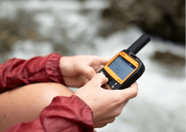
Stay Connected Anywhere: A Review of the Garmin GPS Tracker Series
Introduction to Garmin GPS Trackers Being able to navigate through unknown terrain or communicate in remote locations is crucial to preserving your safety. One invaluable tool that empowers individuals to explore with confidence is a Garmin GPS tracker. Garmin is a leader in GPS technology and offers a range of handheld GPS devices designed to accompany you on your journeys, whether you're hiking through rugged trails, navigating open waters, or embarking on a cross-country road trip. In this article, we'll explore the significance of staying connected wherever you go and why investing in a Garmin GPS tracker is a wise decision. With the convenience of online shopping, it's easier than ever to buy handheld GPS online. Whether you're a seasoned outdoor enthusiast or a casual adventurer, having a reliable GPS tracker at your fingertips can make all the difference in ensuring a safe and enjoyable experience. Exploring the Range: Overview of...
Read more
Award-Winning Weather Forecast System "PredictWind" joins XGate
We are very excited to announce the newly integrated weather service from RedPort Global. They introduced XGate almost fifteen years ago and in that time it has firmly cemented itself as the world’s leading independent satellite data services suite. The newest addition to the XGate suite of services is an award-winning weather forecasting system called PredictWind. PredictWind provides both online weather forecasts and forecasts via satellite. There are three levels of service to choose from: PredictWind Free for XGate: allows users to request, download and view worldwide weather forecasts using their satellite phone (free for active XGate subscribers) PredictWind Standard: as above plus proprietary detailed world weather maps, departure planning, weather routing and increased local resolution PredictWind Professional: as above plus highest resolution weather GRIB files, best current and tidal information available “Satellite phone users are often in areas where accurate, up-to-date weather forecasts are critical to their activities, whether...
Read more
Global Telesat Communications to exhibit at Seawork Exhibition
Global Telesat Communications Ltd (GTC) will be exhibiting for the first time at this year’s Seawork Exhibition which is taking place from 14th-16th June in Southampton. On our stand, number SB35, we will be showing a range of maritime satellite communications equipment, including fixed and handheld terminals, such as the new Inmarsat IsatPhone Pro, as well as solutions from Iridium and Thuraya. GTC will also have its FleetBroadband products on display, together with the SmartOne Satellite Tracker, designed to provide security and tracking for all craft, from ships’ tenders or oil rig supply vessels, to harbour launches and fishing boats. Experts will be available to discuss all equipment options and to advise upon individual requirements, installations and airtime packages.
For more information on Seawork please visit www.seawork.com
Read more
Extreme Athletes use SPOT Gen 3 at Marathon Des Sables
1250 athletes are due to compete in the gruelling 2016 Marathon Des Sables. Fortunately, they will have one less thing on their mind. Thanks to the agreement with SPOT, they will each receive a SPOT Gen 3 satellite tracker for the duration of the race. SPOT has a proven track record in this race after 18 athletes were rescued last year thanks to the SPOT Gen 3. Marathon Des Sables The extreme race takes place in one of the world’s most inhospitable climates - the Sahara Desert. The competitors can expect to run in temperatures that sour as high as 50 degrees Celsius! Therefore this is one of the most challenging and dangerous races in the world. Hence, the need for the service provided by the SPOT trackers. SPOT Gen 3 Tracker The SPOT Gen 3 will track each runners progress in near real-time. Therefore, allowing race organisers and emergency...
Read more

Celebrating the Return of the Southampton Boat Show with 10% Off Our Bestselling Beacons, Trackers, and Hotspots
10% Off Locator Beacon and Flares Offer Show: 10th–19th September To celebrate the return of the Southampton Boat Show, we’re putting your safety in mind by offering a fantastic 10% off selected SOS beacons, flares, inReach trackers and Iridium Go! until September 19th. We have chosen these bestselling devices because they are trusted, reliable and even recommended, by national marine safety institutions like the RNLI. View all products on offer > Our range of Personal Location Beacons (PLBs) and flares could be your lifeline in an emergency on land or at sea. They complement each other perfectly meaning it is best to set off with each of them in your rucksack. They are as compact as they are cost-effective, with no subscription costs whatsoever. Our PLBs have global coverage while our flares can be seen from over seven miles away. Ocean Signal rescueME PLB1 World's smallest waterproof PLB that can...
Read more
The World's First 'Double' Marathon Des Sables
Gavin Sandford is currently competing in the toughest footrace on Earth, the Marathon Des Sables, the extreme race takes place in one of the world’s most inhospitable climates - the Sahara Desert. Competitors are expected to complete the gruelling 250km race over 6 days running in temperatures that sour as high as 50 degrees Celsius making the race one of the most challenging and dangerous in the world – and Gavin has decided to do this twice!
Gavin's Journey
Gavin will cover 500km in 12 days and is carrying everything he needs on his back. We are providing him with Thuraya satellite phones, a DeLorme inReach SE Satellite Tracker so his team can track him and an Isathub for emails and data requirements.
Contact Us
For more information about these devices, please contact us.
Read more
Christmas 2016 Gift Ideas
Get some inspiration for Christmas gifts this year with a selection of our 2016 bestsellers Gadget Lover: Iridium GO! WiFi Hotspot Turn your smartphone or tablet into a global communications device capable of making reliable voice calls and data connections anywhere in the world! Simply flip up the integrated antenna and the battery-powered unit will connect quickly and automatically to Iridium's LEO satellite constellation creating a Wi-Fi hotspot within a 30.5m radius. Buy online today Sailing Enthusiast: ACR ResQLink PLB The only inherently buoyant PLB on the market, ResQLink has become a bestseller not only with sailors but among a wide range of our more adventurous customers. This full-powered, GPS-enabled rescue beacon is designed to quickly and accurately relay your position to a worldwide network of search and rescue satellites in an emergency situation. Buy online today Adventurer: SPOT Gen3 Satellite Tracker Wherever you travel, the SPOT 3 allows you...
Read more

The Next Big Thing in Asset Tracker Systems
What Is An Asset Tracking System? Put simply, an asset tracking system is a way of managing and monitoring an individual’s or company’s valuable fixed or mobile assets. GTC has its own bespoke asset tracking system, GTCTrack. Asset tracking systems exist as online portals that people can create accounts on. From there, users register their satellite asset tracking device, mount it on the asset they wish to track (if they haven’t done so already) and begin monitoring the status and whereabouts of the asset or assets. In What Ways Do They Work? By being accessible online it means users can log in to their asset tracking account from anywhere in the world. One of the key benefits of an online asset tracking systems such as GTCTrack is that it can communicate across distances and keep accurate, up-to-date logs for everyone using it. There are also smartphone tracking and vehicle tracking...
Read more

Rockall Challenge: Staying Reliably In Touch 200 Nautical Miles West of Mainland Scotland
Quick Stats: The what: record attempt at longest stay on Rockall The where: north Atlantic Ocean The why: fundraising for The Royal Navy and Royal Marines Charity and ABF The Soldiers’ Charity The who: Chris 'Cam' Cameron We get a lot of customers at GTC looking to break world records all over the planet. From running across Australia, to floating over the Atlantic Ocean in a long-distance balloon, these amazing people come to us for one thing: to stay reliably connected whether through voice communication or digital data points like remote tracking. Chris 'Cam' Cameron, is no different. The former Gordon Highlander, trained marine biologist and oceanographer, commercially qualified skipper and Yacht-Master Offshore, and all-round professional on the water since 1992 Cam is no stranger to harsh environments at sea. Thanks to such experience and expertise, Cam is currently attempting to stay for 60 days and set a new world record for the longest time spent on Rockall,...
Read more
Globalstar Returns to Profitability
Globalstar, Inc. (Nasdaq:GSAT) announced yesterday its financial results for the three-month and twelve-month periods ended December 31, 2011. For the first time in four years, the Company reported positive quarterly Adjusted EBITDA. Globalstar revenue increased 5 percent to $17.4 million in the fourth quarter 2011 compared to $16.5 million in the fourth quarter 2010. Revenue for 2011 increased 7 percent to $72.8 million compared to $67.9 million in 2010. During the fourth quarter of 2011, Adjusted EBITDA was $1.6 million compared with negative Adjusted EBITDA of $4.3 million during the same period in 2010. Globalstar launched 12 second-generation satellites during 2011. This year, the Company is expected to become the world's first LEO-based MSS provider with a second-generation constellation. Globalstar's fourth satellite launch is planned to take place in the second half of 2012. Globalstar customers responded to the improved coverage afforded by the launched satellites by increasing usage of...
Read more
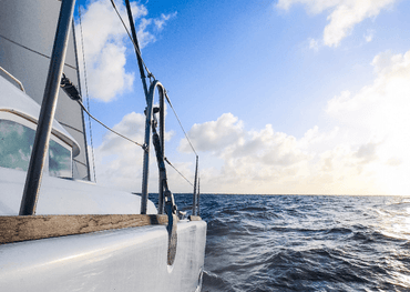
Our Top Picks for Staying Connected on an Atlantic Crossing
Crossing 2,700 NM of Atlantic Ocean presents a multitude of challenges, and it goes without saying that preparation and the need to be fully equipped is paramount. The 2021 edition of the Atlantic Rally for Cruisers (ARC) event takes to the waters on the 21st November and takes even the most experienced sailors weeks to complete. It is therefore critical that, on a journey like this, there are means of reliable data transmission onboard every vessel in order to stay connected with fellow cruisers, friends, and family. Below are the satellite communications devices we recommend for an ocean-crossing adventure like the ARC 2021. Rapid Data Send and Retrieval The VesseLink 200 from Thales harnesses the power and reliability of Iridium Certus broadband to deliver upload/download speeds of up to 176 kbps. Make calls, send and receive emails, and download essential weather information. For those taking part in the ARC, it’s...
Read more